najlepsze-wzory
mapy
zdjecia
Oryginalny obraz nie zawiera znaków wodnych.
Zdjęcia na płótno autora Peter Hermes Furian
FILTRUJ WYNIKI
Orientacja obrazów: wszystkie
pozioma
pionowa
kwadratowa
Rodzaj obrazów: wszystkie
zdjęcie
ilustracja
wektor
 East Coast of the United States, gray political map. Also Eastern Seaboard, Atlantic Coast, and...
 Great American Total Solar Eclipse, on April 8, 2024, political map. Major cities in the path of...
 Evolution of a Koch snowflake, a fractal curve, first five iterations. Starting with an equilateral...
 White Koch snowflake, a fractal curve, fifth iteration, over black. Starting with an equilateral...
 Evolution of a Sierpinski arrowhead, a plane fractal curve. First five steps of developing the...
 Cantor ternary set, 6 iterations, example of a fractal string, or a rooted binary tree. Built by the...
 Sierpinski triangle, a plane fractal, seventh iteration step. Starting with a triangle, subdivided...
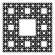 Sierpinski carpet, plane fractal, sixth step. Starting with a square, cut into 9 congruent...
 Evolution of a Sierpinski triangle, a plane fractal. Starting with a triangle, subdivided into four...
 Sierpinski carpet, plane fractal. Starting with a square, cut into 9 congruent subsquares, the...
 West Coast of the United States, with Alaska and Hawaii, political map. Also known as Pacific Coast...
 Inca Empire, map with Suyus, and main roads on coast and mountain side. The four regional quarters...
 Aztec Empire with tributary provinces, maximum extent of Triple Alliance, history map. Tenochtitlan,...
 Germany, political map in the green color of a soccer field. German football cities of the 2024...
 Silicon element on the periodic table. Chemical element and semiconductor with symbol Si and atomic...
 Paros, Greek island, gray political map. Island of Greece in the Aegean Sea, west of Naxos, and part...
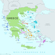 Islands of Greece, political map. Greek islands groups and clusters. The Cyclades, Dodecanese,...
 Northern France, gray political map. Coastline of France and United Kingdom along the English...
 Bay of Biscay, also known as Gulf of Gascony, gray political map. Gulf of the northeast Atlantic...
 Southern France coastline, gray political map. Southernmost part of France, bordering the...
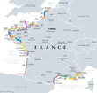 Coasts and beaches of France, political map. Commonly used and popular names of most important...
 Germany, officially the Federal Republic of Germany, political map. Country in Central Europe with...
 United States of America, gray political map. Fifty single states with their own geographic...
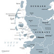 Nordfriesland, or North Frisia, gray political map. Northernmost district of Germany, part of...
 Principal tectonic plates of the Earth, world map. The sixteen major pieces of crust and uppermost...
 Head with mask large headdress, an ancient Mexican motif. Pre-Columbian, Aztec flat clay stamp...
 Finger Lakes region in New York State, United States, gray political map, with most important...
 Southeast Region, South of the United States, gray political map. Geographic and cultural region,...
 Kinmen, also known as Quemoy, gray political map. Group of islands governed as county by Taiwan, the...
 Gulf States of the United States, also called Gulf South or South Coast, political map. Coastline...
 Radiating feathers, 16 feathers rotating around a center, framed by circles. Probably the symbol for...
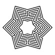 Hexagonal maze, star-shaped, six-pointed labyrinth in seven courses, with a collection of paths from...
 East Coast of the United States, gray political map. Also Eastern Seaboard, Atlantic Coast, and...
 Great American Total Solar Eclipse, on April 8, 2024, political map. Major cities in the path of...
 Evolution of a Koch snowflake, a fractal curve, first five iterations. Starting with an equilateral...
 White Koch snowflake, a fractal curve, fifth iteration, over black. Starting with an equilateral...
 Evolution of a Sierpinski arrowhead, a plane fractal curve. First five steps of developing the...
 Cantor ternary set, 6 iterations, example of a fractal string, or a rooted binary tree. Built by the...
 Sierpinski triangle, a plane fractal, seventh iteration step. Starting with a triangle, subdivided...
 Sierpinski carpet, plane fractal, sixth step. Starting with a square, cut into 9 congruent...
 Evolution of a Sierpinski triangle, a plane fractal. Starting with a triangle, subdivided into four...
 Sierpinski carpet, plane fractal. Starting with a square, cut into 9 congruent subsquares, the...
 West Coast of the United States, with Alaska and Hawaii, political map. Also known as Pacific Coast...
 Inca Empire, map with Suyus, and main roads on coast and mountain side. The four regional quarters...
 Aztec Empire with tributary provinces, maximum extent of Triple Alliance, history map. Tenochtitlan,...
 Germany, political map in the green color of a soccer field. German football cities of the 2024...
 Silicon element on the periodic table. Chemical element and semiconductor with symbol Si and atomic...
 Paros, Greek island, gray political map. Island of Greece in the Aegean Sea, west of Naxos, and part...
 Islands of Greece, political map. Greek islands groups and clusters. The Cyclades, Dodecanese,...
 Northern France, gray political map. Coastline of France and United Kingdom along the English...
 Bay of Biscay, also known as Gulf of Gascony, gray political map. Gulf of the northeast Atlantic...
 Southern France coastline, gray political map. Southernmost part of France, bordering the...
 Coasts and beaches of France, political map. Commonly used and popular names of most important...
 Germany, officially the Federal Republic of Germany, political map. Country in Central Europe with...
 United States of America, gray political map. Fifty single states with their own geographic...
 Nordfriesland, or North Frisia, gray political map. Northernmost district of Germany, part of...
 Principal tectonic plates of the Earth, world map. The sixteen major pieces of crust and uppermost...
 Head with mask large headdress, an ancient Mexican motif. Pre-Columbian, Aztec flat clay stamp...
 Finger Lakes region in New York State, United States, gray political map, with most important...
 Southeast Region, South of the United States, gray political map. Geographic and cultural region,...
 Kinmen, also known as Quemoy, gray political map. Group of islands governed as county by Taiwan, the...
 Gulf States of the United States, also called Gulf South or South Coast, political map. Coastline...


